The Project: depth of field and gps, moving positions


The experiment/proposal "floating points" lays out a new type of artwork, reading of spaces, and of seeing gps signal and live mapping as 3 dimensional. The use of gps coordinates on the ground has led to a prevailing cartography of the flat plane that is the general earth surface and of its streets, deserts, etc. There are projects looking at shapes and spaces beyond this but in a way of generally fixed position and surface of location as data point.
The gps signal is a net shape laid across thousands of feet of points to map. These points can be at streetlevel, at the tenth story of a building, the 50th story of another, of a hill top observation tower, of a low flying helicopter, a ship moving at sea, or even the international space station. These are all points of latitude and longitude. They also vary greatly in altitude, The way to see gps signal in this sense is that of a mesh net with these points and their surface lying within it and with specific points on them. This opens up a sense of location as varying in altitude and as potentially non-fixed ie moving.
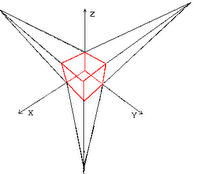
The other factor that is most important is that of how this relates to scope. Think of 3 point perspective. You draw to a horizon line and create forms that display depth. Now imagine these drawing made up, at a few feet, at several feet, and at greater distances. The objects are the same, but the scope of their information and detail to view shifts radically. The works are all of the same subject and space, but are totally different. The same is true for cities. The same is true for landscape.
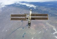
This experiment/project will look at the International Space Station (ISS) as both a (moving) location and of a point of altitude to trigger art in cities below. This will allow for the information to be a narrative of place and of data, but set to change in scope of detail, of narrative form and expanse and of shape with shifts in altitude from the ground to flight level.

The work will have an advanced type of google earth model, but one with the space station tracked along its outer atmosphere. When the astronauts post a report or diary entry it will be encoded as a form above the earth, at the precise location the astronaut was above when he communicated. This entry/icon is, in a graphic/tracking sense, a "location"

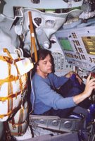
The work will also track the forms of communication made by the temporary residents of this non-fixed location (astronauts on specific missions). The type of language used and level of collaboration will form an architectural shape over time gridded in a 3d space by time intervals.
This creates another recontextualization of "location":: that of the finite experiental location. The astronaut lives in a place like a small section of earth, but machine made and in orbit, and does so only until a mission is over and then they return to where that location is not visible but with tracking software on a computer and the corrolated website. The shape made by the graphic engine will therefore create essentially the experiental form, or "place" as expressed by the astronauts in flight. It will be an architectural model but formed by communication, experience, tasks and the temporary.


0 Comments:
Post a Comment
<< Home