quiet...does not mean inactive...

been working on a lot of the concepts and functionalites of the project.....have not posted here in a while......seeing other projects and research beginning to merge into the concepts here....which is exciting....
also looking forward to feedback when the project is mentioned soon in a magazine article about my work in a computer magazine...
my collaborator alexander is now at nasa eames so looking forward to more input from those folks as we progress....
seeing more and more how the google earth hack aspect will come to play as well as the flighpath triggered data and 3d visualization of communication
on a side note....making a lot of progress on a new non euclidian geometry based topological modelling of event time.......will lecture about this soon as a keynote speaker in Russia......also developing the linkage of this to floating points....very interesting indeed...
Labels: 3d, art, esa, flight, geometry, google earth, gps, immersive visualization, locative media, nasa, path, space, space art, time, vector
floating points progress....collaborations


Gathering team support now. Looking more into what cities will likely lie within the flightpath and what the teams will be to help build the works at these cluster areas of latitude and longitude positions and the signals and semiotics of each area to begin from. It is interesting how cities have "faces" in a sense as far as how they are perceived as an accumulative nexus and how this seems to differ city by city...This might be interesting to work with.
can now tell the whole story about the project
Have had to wait quite a while to let it be known that this is not an "experiment" or hypothetical theory.
The project has been in early development since long before I was in the Cultural Utilization of Space Exploration conference many months ago now. I had to wait until the report to the european space agency was made public to talk of the project itself.
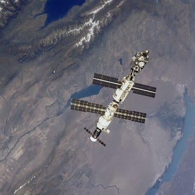
The project may well be one of the most ambitious artworks ever attempted as well as pushing into newer territory on a couple of fronts. The artwork will essentially span the earth in a circle of cities of spaces beneath the international space station's orbit as well as on the iss itself and in museum kiosks in different parts of the world.
It will be quite a task but also what my work to this point has built to.
would love any comments but the world of blogs tends to be one of reading......would be nice though...
FLOATING POINTS PROJECT SHORTLISTED FOR POTENTIAL WORK WITH EUROPEAN SPACE AGENCY
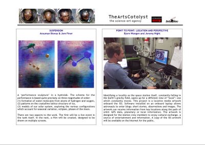
A CULTURAL POLICY FOR THE INTERNATIONAL SPACE STATION
The Arts Catalyst's Report to the European Space Agency
http://www.artscatalyst.org/projects/space/ISS.html
In 2005, the European Space Agency (ESA) awarded the The
Arts Catalyst in London a contract to carry out a study into
possible future cultural utilisation of the International
Space Station.
The study set out to investigate and focus the interest of
the cultural world in the International Space Station, to
generate a policy for involving cultural users in the
International Space Station programme in the longer term and
to develop a representative set of ready-to-implement
demonstrator projects in arts, culture and media. Under the
lead of the Arts Catalyst (GB), the study team also
comprises Association Leonardo- Olats (F) and Delta Utec
(NL), with the MIR network.
The Arts Catalyst submitted its report to the European Space
Agency in early 2006. It is still to be approved by ESA,
however permission has been given to makes its contents public
floating points.....narrative archaeology and my aunt passing away

As I mentioned on my other blog, my aunt died recently after 6 weeks of being day to day terminal with cancer. We buried her a few days ago. She was my close friend , my first mentor, an amazing person and strong to the end. It has been really hard. We talked many times about the ideas around my work and she inspired me and always will.
Looking at the different facets of "floating points". It feels a lot like how it felt as I wrote "narrative archaeology" and worked on 34 north 118 west. That was different as it was all a rush at once in the most amazing epiphany in my life one day standing outside the downtown library with a hand full of photocopies of turn of the last century newspapers. The light was exceptionally bright.....one of those days where high ice crystal clouds make a prism effect on the sun and it feels heightened already ........it almost felt like my body briefly got lighter as did the light as it hit me. Now it is a more long term build but the scope feels similar, the applications, the excitement about the ideas, tools, applications and project(s). It can really deepen the content, flux and interactivity of locative narrative, of reading of spaces, of sound and visual work dealing with scope and space in many contexts, in a more internal ai functionality of data engine and a cohesion in change with increment, applications in seeing the invisible ( flight paths, previous flight paths, previous paths of storms, of protests....
Looking for people along the way to join the team. The final work is extremely ambitious and shall be a group of locative works triggering in cities and between spaces around the world as one unified work of art, narrative, and navigation.
The 3d grid of gps changing with position and elevation will allow greater depth, change and reading of movement and perspective in many ways....this is exciting as it expands on the current modes of locative media and on all I have done to this point.
I miss my aunt but know she will be with me always in memory and inspiration and my love for her and her wise words since I was a boy drive me on even now as I feel the weight of the last few days.
floating points, trajectory and narrative
May have the tool needed for development. Now it is time to begin building the team deeper to design the proper device. The projects are split in three and will expand upon my current theory into applications. Seeing a lot more narrative potential in many variations of scale and scaling beyond just elevation. there is a sort of data raster/vector scan/ rendering capability that can adjust on many scaling levels not in visual but in data and variation, a sort of information engine in a 3d space. Interesting possibilities here.
Have been studying trajectories and readings and see a clear way to present them graphically that shifts with distance and holds not only position points as spires on the line , but also of embedded data .
floating points discussed at isea....now phase 2
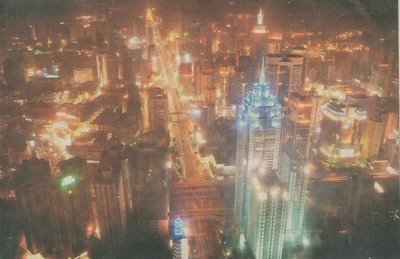
Remote speaker presentation to ISEA went well on friday. It was a lot of fun and got some solid feedback. Now the emphasis branches into a few directions
1. research and development of a hand held that will "read" spaces from above as well as from the ground and places above ground level (moving to the 10th floor of a building and out on the ledge , a hilltop...etc) shifting data and inherent narrative therin with increments of elevation/altitude.
2. research and development of handheld that will "read" trajectories of previous flights both in terms of locative and graphically with a 3d depth of movement and interaction as one moves both horizontally and vertically. This will be a tool for artworks as well as pragmatic applications in data visualization as is the part of the project above.
3. work on experiment for space station and its 3 core sections
4. work on essays that lay out these concepts and their many applications.


